Urban, City, Regional, Town & Country Planning
Basic Fundamentals of Urban Development and Planning
Saturday, 17 January 2026
Sunday, 4 January 2026
World Urbanisation Prospects 2025 — Key Facts
The UN DESA report highlights how rapidly the world is urbanising, with cities becoming the core of global population and economic activity.
 45% of the world’s population (≈ 8.2 billion) now lives in cities.
 Number of megacities (10M+ population) rose from 8 in 1975 → 33 in 2025.
 Jakarta is now the most populous city, followed by Dhaka, Tokyo, and New Delhi.
 44% of India’s population now lives in towns and cities.
 India, along with six other countries, will add over 500 million new urban residents between 2025–2050 — the largest global increase.
Thursday, 1 January 2026
Year- End Review 2025: Department of Land Resources
Department of Land Resources is implementing two Schemes/ Programmes:
- Digital India Land Records Modernization Programme (DILRMP) and
- Watershed Development Component of Pradhan Mantri Krishi Sinchayee Yojana (WDC- PMKSY)
1. Digital India Land Records Modernization Programme (DILRMP): Achieving Saturation
The Department achieved near-total saturation in the core components of land record digitization, effectively shifting land administration from "in-line" to "online".
- Computerization of RoRs: Completed in 97.27% of villages nationwide.
- Digitization of Maps: Cadastral maps have been digitized for 97.14% of the country.
- Text-Map Integration: A critical milestone where 84.89% of villages have successfully linked their textual Record of Rights (RoRs) with spatial cadastral maps.
- Impact: Citizens in 19 states can now download digitally signed, legally valid land records from home, and banks in 406 districts can verify mortgages online, significantly speeding up credit access.
2. NAKSHA: Revolutionizing Urban Land Records
Addressing the complexities of urban land management, the NAKSHA (National Geospatial Knowledge-based Land Survey of Urban Habitations) pilot programme made rapid progress in 157 Urban Local Bodies (ULBs).
- Aerial Survey: Aerial flying was completed in 116 ULBs (87% of targets), covering ~5,915 sq. km with high-resolution imagery.
- Ground Truthing: Initiated in 72 ULBs, with 100% completion achieved in 21 cities.
- Incentivizing States (SASCI): Under the 'Scheme for Special Assistance to States for Capital Investment (SASCI) 2025-26', the Department successfully recommended ₹1,050 Crore in funding to 24 States/UTs that achieved specific NAKSHA milestones.
3. Strategic Launches: Land Stack and Glossary of Revenue Terms
The year concluded with two landmark initiatives launched on 31st December 2025.
- Land Stack: Launched as a pilot in Chandigarh and Tamil Nadu, this GIS-based platform integrates land, ownership, registration, and building data. It enables departments (Revenue, Survey, Registration, Local Bodies) to operate on a unified, interoperable platform, drawing from global best practices.
- Glossary of Revenue Terms (GoRT): To address the linguistic diversity of India's land administration, a glossary was released to harmonize terms like Khasra, Dag, and Pula. It provides meanings in Vernacular, Hindi, English, and Roman scripts to ensure data interoperability without replacing State-specific terminology.
4. ULPIN (Bhu-Aadhaar): A Unique Identity for Land
The Unique Land Parcel Identification Number (ULPIN), a 14-digit alphanumeric code based on geo-coordinates, has been established as the "Aadhaar for Land".
- Coverage: As of November 2025, ULPIN has been assigned to over 36 crore land parcels across 29 States and UTs.
- Benefits: It eliminates duplicity, prevents benami transactions, and paves the way for a unified land ecosystem.
5. NGDRS: One Nation, One Registration
The National Generic Document Registration System (NGDRS) has streamlined property transactions, promoting "Ease of Doing Business".
- Adoption: Implemented in 17 States/UTs, including Punjab, Maharashtra, and Himachal Pradesh.
- Integration: 88.6% of Sub-Registrar Offices (SROs) are now integrated with revenue offices, enabling automatic mutation of land records immediately after registration.
6. Policy Reforms and Social Impact
- Gender Column in RoR: In a historic step towards women's empowerment, a mandatory Gender Column was introduced in the Record of Rights. This allows for the generation of gender-disaggregated data to support women-centric policies and targeted benefit delivery.
- Revenue Court Case Management System (RCCMS): To tackle the backlog of land disputes, 22 States have deployed RCCMS. The system offers online filing, real-time tracking, and integration with land records to reflect court orders instantly.
- Land Acquisition (RFCTLARR Act, 2013): The Division continued to enforce fair compensation and rehabilitation standards, ensuring that land acquisition remains humane, participative, and transparent.
7. Institutional Strengthening: Centers of Excellence (CoE)
To sustain these reforms, the Department expanded its network of Centers of Excellence (CoEs) to six, adding a new institute in Gujarat this year. These centers provide critical training on drone surveys, GIS, and modern land laws.
S.No. | Name of CoE | Jurisdiction (States/UTs) |
1 | YASHADA, Pune | Maharashtra, MP, Chhattisgarh, Goa |
2 | ATI, Mysore | Karnataka, Kerala, TN, AP, Telangana, Puducherry, A&N, Lakshadweep |
3 | ASSTC, Guwahati | Assam, NE States (Tripura, Manipur, etc.) |
4 | MGSIPA, Punjab | Punjab, Haryana, HP, J&K, Chandigarh, Ladakh |
5 | LBSNAA, Mussoorie | UP, Uttarakhand, Bihar, Jharkhand, WB, Odisha |
6 | DISRA, Gandhinagar | Gujarat, Rajasthan, Delhi, D&NH, D&D |
8. Financial Discipline
For FY 2025-26, nearly 60% of the budget was utilized by mid-November, reflecting the accelerated pace of implementation.
2. Watershed Development Component of Pradhan Mantri Krishi Sinchayee Yojana (WDC- PMKSY)
- Watershed Development Component of Pradhan Mantri Krishi Sinchayee Yojana (WDC-PMKSY): The scheme has a Central Share of Rs. 8,134 crore for development of rainfed and degraded lands for a period from 2021-22 to 2025-26. The target area of WDC-PMKSY 2.0 (49.50 Lakh ha; corresponding to the Central Share of Rs 8,134 crore) was allocated to States/UTs and Department sanctioned 1220 projects covering an area of 52.93 lakh ha at a total cost of Rs. 12,972.86 crore (Rs. 8,487.97 crore as Central share) to 28 States and UTs (J&K and Ladakh). A cumulative amount of Rs. 5576 crore of Central fund has been released to States/UTs under WDC-PMKSY 2.0.
- The Department has sanctioned additional 70 watershed projects to 10 States based on the performance.
- The achievements have been as follows (01.04.2025 to 30.09.2025) :
- 17,237 Water harvesting structures created / rejuvenated
- 35,882 ha Additional area brought under protective irrigation in hectares
- 4.86 lakh Farmers benefitted
- 13,953 ha Plantation (afforestation/ horticulture) done
- Watershed Yatra: A mass outreach campaign titled “Watershed Yatra” was conducted during February 2025 to May, 2025, to create awareness (जनजागृति) about the Watershed Development activities carried out under WDC-PMKSY 2.0 and to generate people’s participation (जनभागीदारी) in project areas.
The Watershed Yatra was organized in 26 states and 2 Union Territories. The activities included bhoomi poojan of new woks, lokarpan of completed works, administering of bhoomi aur jal sanrakshan pledge, shramdaan, watershed ki panchayat, Watershed Janbhagidari Cup etc. The Yatra which was held in 2045 locations saw 10,432 lokarpan, 3,769 bhoomi poojan, shramdan at 1902 locations, plantation of 2,18,661 saplings and an overall footfall of more than 8.5 lakh people. Learning Management System (LMS) for Watershed Development has been developed and participated by 10,557 participants.
The Yatra has helped in dramatically increasing people’s participation in the implementation of the scheme.
Watershed Janbhagidari Cup
To sustain the momentum of the Watershed Yatra, the Watershed Janbhagidari Cup was launched to foster community ownership and healthy competition among watershed projects.
Over 250 non-profit organisations have been engaged, and about 1,958 works are being undertaken through Janbhagidari at an estimated cost of ₹55.91 crore.
- Watershed Mahotsav: On 11th November 2025, a nationwide campaign titled “Watershed Mahotsav” was launched by the Union Minister of Rural Development, in the presence of the Minister of State for Rural Development & Communications, to further strengthen public participation in watershed initiatives. Activities included award distribution under the Watershed Janbhagidari Cup, Lokarpan, Bhumi Pujan, Shramdaan, plantation drives, and the launch of Mission Watershed Punarutthan for repair and maintenance of earlier watershed assets. A Social Media Competition was also introduced to enhance outreach and visibility.
- Springshed Development activities: More than 4595 Springs have been identified by the 15 States for development under WDC-PMKSY 2.0 wherein 3357 Springs have already been rejuvenated resulting in major improvement in discharge volume and period of availability of Spring water.
- Under the World Bank aided REWARD program, draft National Technical Guidelines for next generation watershed projects have been finalized. It aims at integrating new age technologies like Land Resource Inventory (LRI), Hydrology and Decision Support System (DSS) based on digital soil mapping for scientific watershed planning and execution.
- A proposal of EFC Memo for next phase of the WDC-PMKSY 3.0 has been prepared with a total cost of Rs. 16253 cr. (Central share of Rs.10938 cr.) for taking up of conventional watershed projects plus some innovative components to be implemented outside watershed project areas such as (i) Development of 15,000 Springs (ii) Rejuvenation of rivers / streams that are on the verge of drying up or have dried up to be taken up in 8 Major States and (iii) Rejuvenation of Water bodies (including Traditional Water bodies) - to address the need of development of drought prone and rainfed areas not covered under the conventional watershed project. Extensive discussions and consultations with all the relevant stake holders i.e. State Governments, research institutes /relevant scientific organizations, ICAR Institutes, public /Pvt. sector agencies, relevant reputed NGOs have been undertaken in connection with preparation of proposed EFC memo of WDC-PMKSY 3.0.
- The importance of Natural Farming is strongly emphasized at the national level. Considering that the objectives of Natural Farming are closely aligned with the goals of soil health conservation, ecosystem restoration, and sustainable land management, the Department proposed to promote Natural Farming on a pilot basis in about 50,000 hectares under the proposed WDC-PMKSY 3.0, as a strategic intervention towards climate-resilient and sustainable agriculture.
- A two-day National Watershed Conference was organised on 10–11 November 2025 at Guntur, Andhra Pradesh, to review the progress of WDC–PMKSY 2.0 and deliberate on the roadmap for future watershed programmes beyond 2026.
- National Conference on Land Resource Inventory (LRI) for Sustainable Watershed Management held during 3–5 June 2025.
- International Conference on “Watershed Resilience: Integrating Science, Sustainability, and Society”, organised during 26–28 November 2025 at Bengaluru under the World Bank-assisted REWARD Programme, with participation from global experts, national institutions, State Governments, and civil society organisations.
The initiatives undertaken during 2025 reinforce the Government’s commitment to sustainable watershed management, climate resilience, community participation, and long-term water security for rural India.
Wednesday, 31 December 2025
India’s Urban Local Bodies Recycle Coconut Waste into Economic and Environmental Gains
Once a stubborn by-product of consumption, waste became an ever-growing challenge with rising populations and rapid urbanization. Answering the call of Prime Minister Narendra Modi through the Swachh Bharat Mission, India flipped the script—under the Ministry of Housing Urban Affair’s (MoHUA) leadership and SBM-U, waste is no longer a problem but a resource, transformed into products and revenue. Nowhere is this shift more evident than in coastal cities, where coconut waste—once a civic headache—has found a second life in the circular economy, turning nature’s leftovers into livelihoods and value.

No Shell Left Behind: Under SBM-U 2.0, coconut waste is powering livelihoods—coastal cities convert it into sturdy ropes and rich organic manure.
As tourists flock to coastal cities seeking clean, safe, and beautiful destinations, coconut water remains the drink of choice by the sea—healthy, refreshing, and hugely popular. That popularity once meant mountains of coconut waste heading to landfills. Not anymore. Today, coconut waste is segregated, recycled, and reborn as value—turned into cocopeat for organic manure and soil alternatives, and coir fibres spun into strong ropes. What was once a seaside problem is now a smart solution.


Coconut waste has transformed from mere “green waste” into a high-value resource. Official data shows coconut husk forms 3–5% of urban wet waste—small on paper, but massive when stacked against the 1.6 lakh tonnes of municipal waste generated daily, rising to 6–8% in coastal cities. With Karnataka, Tamil Nadu and Kerala leading production—and Karnataka now taking the top spot—India is proving that even a discarded shell can crack open big economic value.

India’s coconut story is making serious noise on the global stage. As per Cocunut Development Board and Coir Board, the total production crossed 21,000 million units in 2023–24 and 2024–25, led by Kerala, Tamil Nadu, Karnataka and Andhra Pradesh contributing nearly 90%. Through this the waste-to-wealth value chain is earning both green points and foreign exchange. The global coconut coir market is pegged at USD1.45 billion (about ₹12,000 crore) in 2025, with India commanding over 40% of global production. Fuelled by booming demand for cocopeat in soilless farming—especially in Europe and the US—exports are growing at 10–15% annually, with China (37%) and the US (24%) emerging as the biggest buyers, followed by the Netherlands, South Korea and Spain.
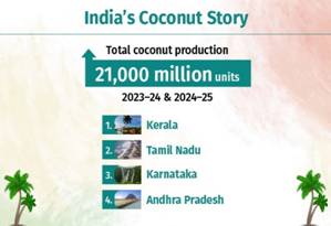
In Karnataka, Bengaluru, Mysuru and Mangaluru, the coconut waste to wealth story is cracking open at scale.generating 150–300 metric tonnes of tender coconut waste every day. Tamil Nadu’s Chennai, Coimbatore and Madurai add significantly to the flow. From Kochi and Thiruvananthapuram in Kerala to Visakhapatnam in Andhra Pradesh, Surat in Gujarat, and Mumbai and Pune in Maharashtra, heavy coconut water consumption has led urban local bodies and private players to develop dedicated husk-management clusters. Setting the benchmark, Mysuru and Madurai have achieved 100% recycling of coconut waste, while religious centres such as Puri in Odisha, Varanasi in Uttar Pradesh and Tirupati in Andhra Pradesh have established specialised Material Recovery Facilities to process temple-generated coconut waste—ensuring that no shell is left behind.
Government schemes are giving coconut waste a serious financial push. Under SBM-U 2.0, entrepreneurs and urban local bodies are receiving robust support, with the Centre offering 25–50% Central Financial Assistance to set up waste-processing plants. The Coir Udyami Yojana sweetens the deal further, providing a 40% subsidy for micro and small enterprises on projects up to ₹10 lakh. Add to that the GOBARdhan scheme, which is rolling out 500 new waste-to-wealth plants to turn coconut residues into compost and bio-CNG—proving that when policy meets sustainability, even waste can turn profitable.

Under SBM-U 2.0, cities are turning coconut waste into opportunity with Material Recovery Facilities (MRFs) and dedicated processing units. Around 7.5 lakh people—80% women running SHG-led units—are part of India’s booming coir sector. With 15,000+ units nationwide (7,766 in Tamil Nadu alone), cities like Indore, Bengaluru, and Coimbatore are keeping 100% of coconut waste out of landfills. Nearly 90% of this waste now becomes ropes, mats, and compost instead of burning away for 10–20 years, emitting carbon and methane. Sustainable, profitable, and employment-packed—coconut waste is getting a serious glow-up.
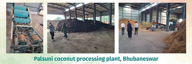
Bhubaneswar’s Palsuni coconut processing plant is turning sacred waste into wealth. It collects 5,000–6,000 coconuts daily from 189 vendors—once discarded temple remnants that clogged drains—and transforms them into 7,500+ kg of coir fiber and ropes, plus 48 metric tonnes of cocopeat-based compost and blocks for farming and gardening. With a 10,000-coconut daily capacity, the plant generates ₹7–9 lakh monthly, while SHG members and Safaimitras gain steady income and dignity through technical training and employment.
Kunnamkulam, Kerala’s Green De-Fibering Unit, with its microbe-enriched cocopeat aerobic composting system is turning coconut husks and wet waste into odor-free compost. Farmers, who once discarded husks, now earn ₹1.25 per husk and deliver them themselves. Run by a six-member team, the unit not only creates local jobs but also teaches advanced composting techniques. Coconut fibers are sold for profit, and leftover short fibers are being turned into innovative bio-pots.
In Greater Chennai, raw coconut husks are converted into compost and coir fiber. Since December 2021, nearly 1.5 lakh metric tonnes of waste have been received, with over 1.15 lakh metric tonnes already processed. Run under a 20-year PPP with WasteArt Communications, the units at Kodungaiyur and Perungudi are operating at full capacity, with a processing fee of about ₹764 per metric tonne. There are nearly 30 regular buyers—including tyre companies, nurseries and forest departments.
In Indore’s coconut waste processing model with a 550 TPD bio-CNG, not a shred of coconut waste goes wasted. Coconut waste is sent straight to a dedicated unit beside the bio-CNG plant, where 20 tonnes are processed daily through a smart dual-line system: the dry line produces cocopeat that boosts soil moisture retention by up to 500%, while the wet line extracts coir fibre for ropes, sculptures and crafts. Spanning 20,000 sq ft and run by 15 workers, the unit earns about ₹20,000 a day, with three major vendors already retailing its products.
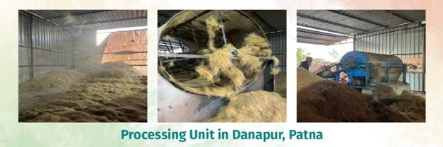
Patna, Bihar is cracking the coconut—literally—with a sharp, zero-cost waste-to-wealth model. A modern PMC processing unit in Danapur is diverting coconut waste from landfills and turning it into value, currently handling 10 TPD. Husks become coir fiber and ropes for packaging, construction, and crafts, while wet waste transforms into high-demand cocopeat and organic compost for rooftops, nurseries, and farms.
From temple towns to tech hubs, India’s coconut waste journey under Swachh Bharat Mission–Urban proves that sustainability thrives when policy, people, and innovation align.
Ministry of Housing and Urban Affairs: Year End Review 2025
Ministry of Housing and Urban Affairs continued to advance its mission of strengthening safe, efficient, inclusive, and sustainable urban mobility across Indian cities.
- From January 2025 (till 29th November 2025) Metro Rail Projects worth Rs 25,932 Crore, covering a total of 84.57 km, have been sanctioned. (Sanctioned Projects List).
- During the current financial year, the operational metro network in the country has surpassed the historic 1,000-km milestone (1,090 km).
- Metro rail services, which were earlier available in 23 cities, have now grown to cover 26 cities, further strengthening nationwide connectivity.
- From January 2025 to date (29.11.2025), about 85.62 km of new metro rail lines have been made operational across the country, contributing significantly to this year’s progress. (See complete List)
- The first phase of the Bhopal Metro, the Orange Line Priority Corridor, was inaugurated on 23 December 2025. The priority corridor spans approximately 7 km and comprises eight elevated stations, namely AIIMS, Alkapuri, DRM Office, Rani Kamlapati, MP Nagar, Board Office Chauraha, Kendriya Vidyalaya, and Subhash Nagar.
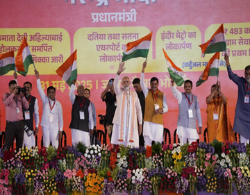
Hon’ble PM inaugurating Stretch of Indore Metro Rail
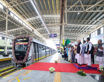
Inauguration by Hon’ble PM of Yellow line from RV Road to Bommasandra
Reforms
- Amendment in the Metro Railways (Procedure of Claims), Rules 2017 to enhance the compensation offered to the parties filing claims to the metro in case of a serious accident or injury.
- Rolling out of the National Common Mobility Card and QR ticketing system in metro and other transportation systems.
- Indigenous development of Platform Screen Door.
- National Urban Mobility India Conference:
The three-days Urban Mobility India (UMI) Conference & Exhibition 2025 was organized on 12–13 November 2025 in New Delhi.
During the Valedictory event the logo of PM e-Bus Sewa Scheme and its website was also launched by Hon’ble Union Minister of Housing and Urban Affairs and Power Shri Manohar Lal.
Website - https://pm-ebus-sewa.mohua.gov.in/
The conference concluded with distribution of awards in 8 different categories of Urban Transport.
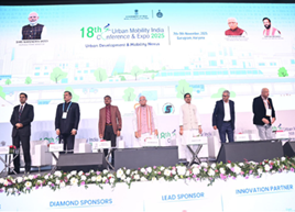
Valedictory event of 18th Urban Mobility India Conference & Exhibition
- PM -eBUS Sewa Scheme
- Official Logo and website of the PM-eBus Sewa Scheme were launched by Shri Manohar Lal Khattar, Hon’ble Minister of Housing and Urban Affairs at the valedictory session of the 18th Urban Mobility India conference.
- The Ministry issued Addendum to the Scheme Guidelines in April 2025 that expanded the definition of ‘eligible cities’ to include clusters of adjoining statutory towns (LPAs) and areas merged post-Census 2011 with combined populations between 3–40 lakh, enabling participation of smaller cities.
- 3,622 buses have been sanctioned in the calendar year (Jan to Dec 2025)
- ₹ 60.73 crore were sanctioned for the development of associated infrastructure which includes Behind-the-meter (BTM) Power and Civil Depot infrastructure.
- Out of 85 Civil Depot proposals, construction work has started in 52 depots spread across 44 cities, and out of 88 BTM proposals, 40 depots have begun works across 33 cities.
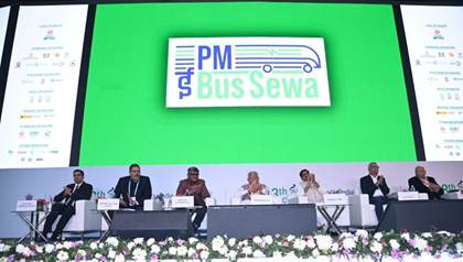
Official logo launch of PM-eBus Sewa S cheme by Shri Manohar Lal, Hon’Ble Union Minister MoHUA at UMI 2025

Construction of associated infrastructure in Nagpur city under PM-eBus Sewa Scheme
2. Central Public Works Department
- Hon’ble Prime Minister of India inaugurated Kartavya Bhavan– 3 at Kartavya Path, New Delhi on August 6, 2025.
- Prime Minister also inaugurated multistorey 184 MP Flats at BKS Marg, New Delhi on August 11, 2025.
- He laid the foundation stone (virtually) for New Building of Central Ayurveda Research Institute at Rohini, New Delhi on January 05, 2025 in the presence of Shri Manohar Lal, Hon’ble Union Minister, MoHUA and Shri Tokhan Sahu, Hon’ble Minister of State, MoHUA.
- Shri Manohar Lal, Hon’ble Union Minister of Housing & Urban Affairs and Power, graced the Skill Development Training Programme organized by CPWD as Chief Guest on June 26, 2025 at GPRA, Kasturba Nagar, New Delhi in the gracious presence of Shri Srinivas Katikithala, Secretary.
(Complete list of Works by CPWD)

Hon’ble PM at the inauguration and visit of Kartavya Bhavan 3, in New Delhi
- SWACHH BHARAT MISSION (SBM)
- 12th regional 3R and Circular Economy Forum for Asia-Pacific
- Jaipur hosted the 12th Regional 3R and Circular Economy Forum in Asia and the Pacific from 3–5 March 2025, bringing together global leaders, policymakers, and experts to advance sustainable development and circular economy practices across the region.
- It was organized under the theme- “Realizing Circular Societies Towards Achieving SDGs and Carbon Neutrality in Asia-Pacific.”
- Jaipur Declaration (2025–34) was adopted and it provided a voluntary framework for transitioning from a linear to a circular economy.

12th Regional 3R and Circular Economy Forum in Asia and the Pacific held in Jaipur
- Swachh Shehar Jodi: The Ministry of Housing & Urban Affairs (MoHUA) launched the Swachh Shehar Jodi (SSJ) initiative, a large-scale urban waste management mentorship programme aimed at transforming sanitation practices acrossthe country’s cities.
Read more: https://www.pib.gov.in/PressReleasePage.aspx?PRID=2172112®=3&lang=2

Launch of Swachh Shehar Jodi (SSJ) initiative by Shri Mahohar Lal Khattar
- Swachhata Hi Seva (SHS) 2025 Campaign:
- Under the Swachh Bharat Mission, the SHS 2025 campaign was conducted from 17 September to 2 October 2025 as a joint initiative of the Ministry of Housing and Urban Affairs and the Department of Drinking Water and Sanitation, Ministry of Jal Shakti.
- The campaign launched an intensive fortnight-long cleanliness campaign with the theme- Swachhotsav aimed at achieving key cleanliness outcomes across urban and rural areas.
- The drive laid special emphasis on:
Cleanliness Target Units, including dark, dirty and neglected spots; visible cleanliness in high-intensity public spaces, with particular focus on legacy dumpsites; promotion of eco-friendly celebrations during upcoming festivals to reinforce sustainable practices; organisation of SafaiMitra Suraksha Shivirs; and advocacy for swachhata.
Ø Union Minister Shri Manohar Lal led the national launch of 'Swachhata Hi Seva (SHS) 2025’ from Delhi’s Bhalswa Dumpsite - adopting the site for its remediation and transformation into a cleaner, more sustainable urban space.

Shri Manohar Lal, Minister of Housing and Urban Affairs visited the dumpsite.
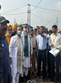
Shri Manohar Lal, Minister of Housing and Urban Affairs inspecting the dumpsite.
Key Highlights of SHS 2025 were:
- Overall citizens participation: 18,54,94,139 citizens participated nationwide.
- Cleanliness Target Units (CTUs): 16,00,500 CTUs transformed with 7,68,03,861 citizens.
- Clean public spaces: 5,75,040 public spaces were cleaned; 6,14,10,224 citizens participated in cleaning public places.
- Clean-green festivities: 4,54,187 eco-friendly pandals were organized; 2,95,500 swachhata rangolis got created; 3,63,766 post-festive cleanliness drives were conducted; 11,13,453 total events conducted.
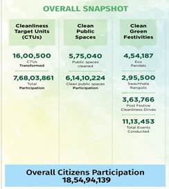
Overall figures for SHS 2025
- Dumpsite Remediation Accelerator Programme (DRAP):
Union Minister Shri Manohar Lal launched the Dumpsite Remediation Accelerator Programme (DRAP) a year-long, mission-mode initiative aimed at fast-tracking the remediation of remaining dumpsites across urban India. The programme seeks to reclaim valuable urban land for community and infrastructure development, thereby advancing India’s vision of achieving “Lakshya Zero Dumpsites” by September 2026.
Currently, 1,428 sites are undergoing remediation, and about 80% of the legacy waste is concentrated in 214 sites across 202 ULBs. DRAP will prioritize these high-impact locations, covering approximately 8.8 crore MT of legacy waste.
Read more: https://www.pib.gov.in/PressReleasePage.aspx?PRID=2187816®=3&lang=2
- World Toilet Day:
The Government of India commemorated World Toilet Day 2025 under the theme “Sanitation: Collective Responsibility for Dignity and Planet,” highlighting the nation’s integrated approach to sanitation, cleanliness, and environmental stewardship.
On this occasion, the Ministry of Housing & Urban Affairs launched the year-long advocacy campaigns ‘Toilet Paas Hai’ and ‘Main Saaf Hi Achha Hoon’
Read more: https://www.pib.gov.in/PressReleasePage.aspx?PRID=2191751®=3&lang=2
X: https://x.com/MoHUA_India/status/1991101183243759925?s=20
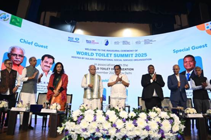
MoHUA Launches ‘Toilet Paas Hai’ & ‘Main Saaf Hi Achha Hoon’
- Pradhan Mantri Awas Yojana – Urban 2.0 (PMAY-U 2.0 / Urban Housing)
- Under PMAY Urban overall 1.22 crore houses are sanctioned and 1.14 crore houses are grounded (till 9th December 2025).
- Union Minister Shri Manohar Lal launched Unified RERA Portal https://rera.mohua.gov.in/ at 5th Meeting of Central Advisory Council constituted under the Real Estate (Regulation and Development) Act, 2016 [RERA].
- MoHUA launched a nation-wide outreach campaign called Angikaar 2025 (4 Sept – 31 Oct 2025) to accelerate last-mile implementation of PMAY-U 2.0.
- This includes verifying applications, facilitating completion of already-sanctioned houses, and raising public awareness — especially among low-income, vulnerable and marginalized urban populations.
Read more: https://www.pib.gov.in/PressReleasePage.aspx?PRID=2164173®=3&lang=2
X: https://x.com/PMAYUrban/status/1978489672952426678?s=20
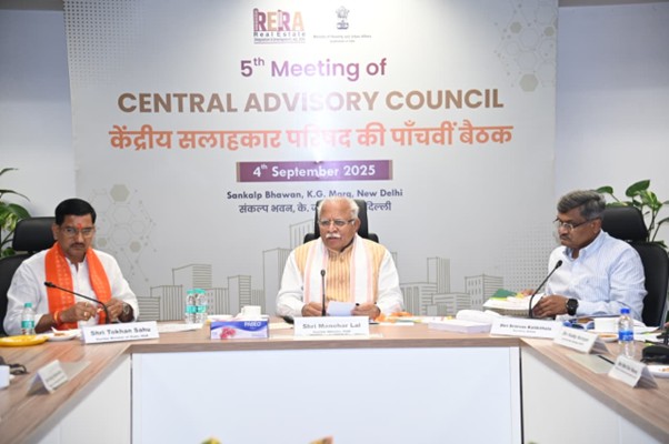
Shri Manohar Lal chaired 5th meeting of Central Advisory Council.
- Key achievements, initiatives and milestones
- The Union Cabinet, on 27th August 2025, approved the restructuring and extension of the PM SVANidhi scheme with lending period upto March 31, 2030.
- PM SVANidhi scheme benefitted over 70 lakh street vendors across India by disbursing more than 1 crore loans amounting to above ₹15,000 crores.
- 48.62 lakh street vendors are digitally active and have conducted 658 crore digital transactions worth ₹7.10 lakh crore.
- ₹353 crores has been paid as interest subsidy.
- Over 1.46 crore sanctions under the eight central schemes have been made for socio-economic upliftment of more than 47.9 lakh Street Vendor families.
- As part of the capacity-building initiative, 53,367 street food vendors received training from FSSAI under the scheme.

Shri Manohar Lal and Shri Anumula Revanth Reddy, Hon’ble CM of Telangana distributes cheques to street vendors.
- Key Reforms and achievements include:
- Enhanced loan amount
- First loan: upto ₹15,000
- Second loan: upto ₹25,000
- Third loan: upto ₹50,000
- Provision of UPI-linked Credit Card
- Digital cashback incentives for wholesale transactions
- Scheme’s coverage expanded beyond statutory towns to census towns
- Capacity building of the street vendors with a focus on entrepreneurship, financial literacy, digital skills, marketing and hygiene & food safety with FSSAI
- ISB’s studies of 2023 and 2025 has assessed the economic impact of the scheme covering an estimated sample of 5,000 street vendors, with around 60% participating in both survey rounds.
- The scheme has enabled deep financial inclusion, with 95% accessing formal credit for the first time and 30% now holding formal bank loans other than PM SVANidhi.
- Income levels have risen steadily, supported by investments in working capital and fixed assets, contributing to nearly 20% annual income growth.
- As per the study, digital adoption has risen sharply from 2023-2025, with UPI usage increasing from around 45% to 83%—creating financial histories that improve access to formal credit.
- The benefits extend beyond business outcomes:
- 66% households made improvement or achieved stability
- 74% reported improvement in access or quality of food
- 50% households reported improved ability to afford health checkups or buy medicines
- 67% reported improved access or better quality of education
- Two special campaigns conducted across all States and Union Territories –
- “Lok Kalyan Melas" - from 17 September to 15 October 2025 across all Urban Local Bodies (ULBs) to accelerate outreach and ensure effective implementation of the scheme.
- “SVANidhi Sankalp Abhiyaan” - from 3 November to 2 December 2025 with focus on clearance of pending Returned by Bank applications by ULBs and loan sanction and disbursement by banks in mission mode.
Read more:
https://www.pib.gov.in/PressNoteDetails.aspx?NoteId=156604&ModuleId=3®=3&lang=1
https://www.pib.gov.in/PressReleseDetail.aspx?PRID=2206995®=3&lang=1

X: https://x.com/pmsvanidhi/status/2001575105206587478?s=20
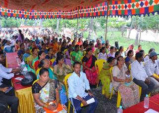
Beneficiaries of PMSvanidhi receiving their loan amount
Achievement under AMRUT & AMRUT 2.0 from 01.01.2025 to 22.12.2025
- ₹33,287 crore worth of projects awarded under the AMRUT 2.0.
- ₹12,538 crore worth of projects completed under the mission.
- 33 lakh water tap connections and 20 lakh sewer connections (including households covered through Faecal Sludge and Septage Management) have been provided/serviced.
- 6,000 MLD of treated water is being reused across States/UTs.
- Under Jal Hi AMRIT (JHA) Initiative, 25 States/UTs have established Water Resource Recovery Cell (WRRC) to enhance the reuse of treated water and biosolids management.
- 28,000+ Women Self Help Group (SHG) members have been engaged under the AMRUT Mitra initiative to support water demand management, water quality monitoring, billing & collection and maintenance of WTP/STP.
- 7,480 acres of water body area rejuvenated.
- 2,704 acres of green space area developed.
Read more: https://www.pib.gov.in/PressNoteDetails.aspx?id=154737&NoteId=154737&ModuleId=3®=3&lang=2
- SMART CITY
- Union Minister of Housing & Urban Affairs, Shri Manohar Lal visited Karimnagar Smart City on 24th January and inaugurated four major projects spanning education, solid waste management, and social infrastructure.
- These included the ₹22 crore redevelopment of Dr. B.R. Ambedkar Stadium, a modern multipurpose School Park built at a cost of ₹12.35 crore.
a. Conferences
i.) National Urban Conclave 2025
- Union Minister for Housing and Urban Affairs, Shri Manohar Lal, inaugurated the two-day National Urban Conclave 2025 at Yashobhoomi, New Delhi on 8th November 2025.
- The two-day conclave brought over 2500 participant from various domains, including policymakers, urban planners, experts, and stakeholders to deliberate on the theme “Sustainable Urban Development and Governance” through intensive brainstorming sessions across six thematic areas.
- Union Minister Shri Manohar Lal launched key initiatives to drive sustainable and inclusive urban development including Dumpsite Remediation Accelerator Programme (DRAP) to achieve “Lakshya Zero Dumpsites by 2026,” reclaiming 7,580 acres of land.
- The Swachh Bharat Mission – Knowledge Management Unit (KMU) at NIUA for capacity building and knowledge sharing.
- The Urban Invest Window (UiWIN) by HUDCO to facilitate private and multilateral investments and promote PPP urban projects.
- Jal Hi Janani, an AMRUT anthem to promote water conservation.
Read More:
https://www.pib.gov.in/PressReleasePage.aspx?PRID=2188050®=3&lang=2
X: https://x.com/MoHUA_India/status/1987392945541292392?s=20

Hon’ble Minister of Housing and Urban Affairs, Shri Manohar Lal culminated the National Urban Conclave 2025 at Yashobhoomi India International Convention Centre, New Delhi.
b. World Habitat Day 2025
- MoHUA observed World Habitat Day 2025 on 8th October.
- The event underscored MoHUA’s commitment to building resilient, inclusive and future-ready cities, emphasising stronger local governance and Public-Private–People Partnerships to enhance urban resilience.
- Key schemes such as PMAY-Urban, AMRUT, PM SVANidhi and Swachh Bharat Mission were highlighted as integrated efforts toward social inclusion, climate action and economic empowerment. Important releases included MoHUA publications and a PMAY-U best-practices compendium, alongside prize distribution for national painting competitions. Panel discussions on integrating peri-urban areas, addressing urban flooding and promoting equitable cities guided future actions aligned with the vision of Viksit Bharat 2047.
Read More:
https://www.pib.gov.in/PressReleasePage.aspx?PRID=2176449®=3&lang=2
8. Consultative Committees Meetings (CCMs)
a. Union Minister Shri Manohar Lal chaired CCM on Swachh Bharat Mission– Urban 2.0 (28 March 2025)
Key highlights:
- Union Minister Shri Manohar Lal chaired the MoHUA Consultative Committee meeting on 27 March 2025 to review the progress and future roadmap of Swachh Bharat Mission–Urban 2.0.
Read More:
https://www.pib.gov.in/PressReleasePage.aspx?PRID=2116136®=3&lang=1
b. Union Minister Shri Manohar Lal Chaired CCM on the Housing and Urban Development Corporation (HUDCO)-Financing Infrastructure for Viksit Bharat (16 December 2025)
Key highlights:
- Union Minister Shri Manohar Lal chaired the MoHUA Consultative Committee meeting on 15 December 2025 to review HUDCO’s role in financing housing and urban infrastructure for achieving Viksit Bharat.
- The Minister emphasized the need for sustained and innovative financing mechanisms to meet rising urbanization demands and ensure timely execution of large-scale housing and infrastructure projects.
Read more:
https://www.pib.gov.in/PressReleasePage.aspx?PRID=2204715®=3&lang=1
9. Regional Conferences and State Visits
a. Regional Meeting of Urban Development Ministers of Southern States and Union Territories (30th October 2025)
- The first regional meeting of Urban Development Ministers was held in Bengaluru on Oct 30, 2025 under the chairmanship of Shri Manohar Lal, Hon’ble Union Minister of Housing and Urban Affairs.
- The meeting brought together Urban Development Ministers from the southern States and Union Territories to deliberate on key issues, challenges, and opportunities in urban development, and to chart a collective way forward.
Read more:
https://www.pib.gov.in/PressReleasePage.aspx?PRID=2184262®=3&lang=1
b. Second regional meet of Urban Development Ministers held in Hyderabad (Nov 18, 2025)
- The second regional meeting of Urban Development Ministers was held in Hyderabad on November 18, 2025 under the chairmanship of Shri Manohar Lal, Union Minister of Housing and Urban Affairs.
- The deliberations centered around key issues, challenges, and opportunities in urban development to chart a collective way forward in line with the first regional meeting which was held in Bengaluru on 30th October’25.
Read more:
https://www.pib.gov.in/PressReleasePage.aspx?PRID=2191335®=3&lang=1
- Third Regional meeting of Urban Development Ministers of North-Central States held in Bhopal (December 20, 2025)
- The third regional meeting of Urban Development Ministers was held in Bhopal on December 20, 2025 under the chairmanship of Hon’ble Union Minister of Housing and Urban Affairs, Shri Manohar Lal.
- The national level meeting of the Urban Development Ministers held on July 17, 2025 in New Delhi laid the foundation of this consultation at the regional level.
- The deliberations centered around key issues, challenges, and opportunities in urban development to chart a collective way forward, in line with the first and second regional meetings held in Bengaluru on October 30, 2025, and Hyderabad on November 18, 2025 respectively.
Read more:
https://www.pib.gov.in/PressReleseDetail.aspx?PRID=2207029®=3&lang=1
10. State Reviews
a. Union Minister Shri Manohar Lal reviewed progress of Urban Development on his visit to Odisha (23 March 2025)
- Union Minister for Housing & Urban Affairs and Power, Shri Manohar Lal, reviewed key urban development and infrastructure projects in Odisha, emphasizing the need to develop Bhubaneswar, Cuttack, Puri, and Khordha as Growth Hubs to strengthen regional economic development.
- He highlighted the importance of enhancing infrastructure, promoting industrial and commercial expansion, and advancing sustainable urbanization through strategic planning and public-private partnerships.
Read more:
https://www.pib.gov.in/PressReleasePage.aspx?PRID=2114183®=3&lang=
b. Union Minister Shri Manohar Lal and Chief Minister of Rajasthan Shri Bhajan Lal Sharma reviewed Centrally Funded urban development schemes in Jaipur (29 April 2025)
- Union Minister for Housing and Urban Affairs, Shri Manohar Lal, and Chief Minister of Rajasthan, Shri Bhajan Lal Sharma, held a review meeting in Jaipur today to assess the progress of Centrally Funded urban development projects in the State.
- The Union Minister reviewed key initiatives, including the Swachh Bharat Mission, PM e-Bus Seva, Jaipur Metro Rail, AMRUT 2.0, and Pradhan Mantri Awas Yojana, focusing on their development, expansion, and financial models.
Read more:
https://www.pib.gov.in/PressReleasePage.aspx?PRID=2125130®=3&lang=2
- Union Minister Shri Manohar Lal reviewed the progress of major urban missions in Bengaluru (23 May 2025)
- Union Minister of Housing and Urban Affairs and Power, Shri Manohar Lal, reviewed the progress of major urban missions in Bengaluru in the presence of senior ministers and officials from the Government of Karnataka and MoHUA.
- Union Minister Shri Manohar Lal and CM Goa Shri Dr. Pramod Savant reviewed progress of urban development schemes in Panaji (12 May 2025)
- Hon’ble Minister for Housing and Urban Affairs, Shri Manohar Lal, met today in Panaji with Hon’ble Chief Minister of Goa, Shri Pramod Sawant, and Shri Vishwajit Rane, Minister for Urban Development, to review the progress of key urban development initiatives in the State.
- The Minister evaluated implementation of major MoHUA schemes, including AMRUT 1.0 & 2.0, PMAY-U, Smart Cities Mission, SBM-U, DAY-NULM and PM SVANidhi.
- During the meeting, the Chief Minister sought special assistance for the 24x7 Drink-from-Tap water supply project, including ₹326.30 crore for source augmentation, network rehabilitation, and smart monitoring systems under AMRUT 2.0.
- The Hon’ble Minister agreed to consider the proposal. The Chief Minister also requested enhanced support under AMRUT 2.0 and SBM-U 2.0 in view of Goa’s unique urban challenges arising from high tourist inflow.
- The Minister acknowledged the concern and directed officials to initiate necessary policy adjustments for tourist-intensive states.
Read more:
http://pib.gov.in/PressReleaseIframePage.aspx?PRID=2128245®=3&lang=2
- Union Minister Shri Manohar Lal met the Chief Minister of Jammu and Kashmir and reviewed urban development schemes and projects in Srinagar (12 June 2025)
- Union Minister for Housing and Urban Affairs, Shri Manohar Lal conducted a detailed review of various urban development schemes and projects in Jammu and Kashmir today (12th June 2025), in the presence of Hon’ble Chief Minister of Jammu & Kashmir, Shri Omar Abdullah, who is also incharge Minister for the department in J&K.
- Regional Meeting of Urban Development Ministers of Southern States and Union Territories (30th October 2025)
- The first regional meeting of Urban Development Ministers was held in Bengaluru on Oct 30, 2025 under the chairmanship of Shri Manohar Lal, Hon’ble Union Minister of Housing and Urban Affairs.
- The national level meeting of the Urban Development Ministers held on July 17, 2025 in New Delhi laid the foundation of this consultation at the regional level.


