

Monday, 17 April 2023
Sunday, 16 April 2023

Friday, 14 April 2023
Zoning Regulations

A Master plan or Development Plan or General Town Planning (GTP) Scheme is a general plan for the future development of a city / any settlement showing both, the existing and proposed streets or roads, open spaces, public buildings, residential, commercial areas etc. and shows various land use zones intended for development. It is a statutory document prepared under the provisions and procedures prescribed under the relevant Acts. The Zoning Regulations are also sanctioned along with the Master Plan. Zoning Regulations is the legal instrument for implementing the land use policy as proposed in the Master Plan. Zoning Regulations contain a set of guidelines with regard to the permissibility of the right use and the correct location of each zone duly prohibiting the conflicting uses in order to achieve the objective of the Master Plan for orderly development of a given settlement.
Zoning is a planning control tool for regulating the built environment and creating functional real estate markets. It does so by dividing land that comprises the statutory area of a ULB into different zones, permitting particular land use on specific sites to shape the layout of towns and cities and enable various types of development. It determines the location, size, and use of buildings and decides the density of city blocks
Need of the Zoning Regulations:
The Master Plans for various urban settlements along their vicinity areas have been prepared at different times for the past several years in the State. Zoning Regulations along with the Master Plans are also issued. It has been observed that some of the Land Use Zone Categories of the Master Plans have been shown differently in each of the Master Plans without following a uniform pattern. Due to this, there are different set of zoning regulations for different Master Plans creating complexity in understanding its applicability. This has led to difficulty among the general public, License Technical Personnel and also among the implementing agencies. Presently, the building permissions are issued through the Online Building Permission System (OBPS) on a single platform in the State. Therefore, it is difficult to customize all zoning regulations on a single platform. Hence, there is an immediate need to develop uniform zoning regulations for the entire State and this will help to avoid manual interpretation and intervention in the application of the zoning regulations.
The zoning regulations is the formal categorization of land-use Plan applicable to land within a Urban local body. It also sets the legal framework. The zoning regulation establishes permitted land uses and distinguishes between different land use types. Further, it ensures that incompatible land uses are not located adjacent to one another. The zoning regulations often also contains information relating to the need for a planning permit for a change of use or development proposal, subdivision of land, construction of new buildings, and other changes to the land.
Rationalization of Land Use Categories of master plans A systematic approach has been followed to rationalize the land uses of Master Plans which include:
a) Comprehensive assessment to understand the commonalities of zones of each Master Plan.
b) Review of existing land use zones of other metro cities Master /Development Plans.
c) Comparison with National Level URDPF guidelines.
d) Consultations with town planning experts and officials of line departments.
Applicability of the ZoningRegulations:
No development activity like layout, land pooling scheme, building activity or use of any land shall be permitted unless these are in conformity with the Master Plan land use, circulation network and the zoning of the uses and activities as given in this section and the building site requirements as given in these regulations.
These regulations however will not prohibit the continuance of existing uses of lands and buildings that have been lawfully established and have a valid development permission obtained from the competent authorities asrequired under the prevailing statutory provisions and these Zoning and Development Promotion regulations, provided that no expansion of the existing non- conforming use or activity shall be permissible provided such conformed use is dangerous to life.
All the layouts approved by the competent authorities as required under the prevailing statutory provisions or plots / layouts regularized by prior to these regulations and change of land use affected by government in the immediate preceding notified Master Plan from time to time shall continue to prevail irrespective of the land use zone proposed in the MasterPlan.
Sunday, 9 April 2023
Preparation of Master Plan
> With rapid urbanization and growth of the city, urban planning has received a major importance. This planning is done at various hierarchies to integrate a large region with a small area so that the development is done at a same pace. There are many legal documents made to promote development. Master plan is one such document which provides rules and guidelines for a planned development both at present and future.
> Master
Plan is an instrument to work out land and infrastructure requirements for
various urban and rural uses, and allocate land for various uses to result in
harmonious and sustainable distribution of activities so that towns / cities
are provided with a form and structure within which they can perform all their
economic and social functions efficiently and effectively. The purpose of a
Master Plan is to promote growth and guide and regulate present and future
development of towns and cities with a perspective of 20-25 years.
Necessity
and Features of Master Plan:
> To
discourage the growth of a city in an unplanned and unscientific way.
> To
control the development of various Land use in a systematic way.
> To
give a Perspective picture of a fully planned city.
> To
plan and account for existing migration of rural population to the urban area.
> To
address the evolving challenges such as Housing, Infrastructure, means of transport, open space development and
insufficiency in public amenities etc.
> For
effective land use management and utilization.
> For
Spatial Growth Management.
> To
enable Project Planning and Urban Management.

City Development Plan (CDP) vs Master Plan
So Many times City Development Plan (CDP) is made in cities with no Master plan. This isolation amount to ignoring an existing legal instrument of city planning and leads to only project oriented development. City Development Plan (CDP) is usually taken as a synonym to a Master Plan, which is a statutory document having gone through the process of `public opinions and objections’ and backing. City Development Plan (CDP) may not be even prepared by professional Planners. It fails to seek advantage of modern data sources as used in development plans and thus may contradict the statutory master plan. JNNURM gets more financials to prepare City Development Plan (CDP) than National Urban Information System (NUIS) for development plans although City Development Plan (CDP) has to be prepared for less number of cities.

City Development Plan
A City Development Plan (CDP) is both a perspective and a vision for the future development of a city. It presents the current stage of the city’s development – where are we now? It sets out the directions of change – where do we want to go? It identifies the thrust areas — what do we need to address on a priority basis It also suggests alternative routes, strategies, and interventions for bringing about the change – what interventions do we make in order to attain the vision? City Development Plan (CDP) is anchored in the Jawaharlal Nehru National Urban Renewal Mission (JNNURM) with a focus on creating economically productive, efficient equitable and responsive cities. Both perspective and vision document for the future development of a city; Developing a vision and selection of strategy is central to preparation; Wide range of consultations among key stakeholders; Defines potential of city, its attributes in terms of comparative and competitive advantage; Includes City Investment Plan: detailed analysis of finances; In depth analysis and review of existing situation.
Process of Preparation of CDP:

Preparation of a City Development Plan is a multi-stage exercise, involving: In-depth analysis of the existing situation, covering the demographic, economic, financial, infrastructure, physical, environmental and institutional aspects. The purpose of this stage is to review and analyse the current status of the city with regard to the state of its development, systems and procedures, as equally its institutional and financial context. Development of a perspective and a vision of the city: Using the results of the first stage of analysis combined with consultations with key stakeholders and civil society, this stage is meant to develop a vision for the future development. Formulating a strategy for bridging the gap between where the city is and where it wishes to go. It is in this stage that strategies and interventions are identified for attaining the vision and future development perspectives. Preparing a City Investment Plan (CIP) and a financing strategy: An investment plan and a financing strategy are an integral part of the CDP.
Strengths of City Development Plan:

Some aspects which even though are emphasized in the master plan but always are down played. CDP highlights like preparation of financial profile of a city, investment plan and strategy plan and infrastructure profile in preparation of CDP, which will go a long way in realizing harmonious and sustainable development of towns and cities. In India, the projects envisaged under the first major urban renewal program (JNNURM) is implemented through CDP, which are essentially city level capital investment plans, prepared largely independently of the city’s Master Plan. This is because the city master plans do not have any financial plan attached to them and have very poor reflection of socio-economic concerns.
Integrated Development of Small & Medium Towns (IDSMT)
The total population of the country has increased from 361 million in 1951 to 1027 million in 2001, whereas, urban population has increased from 62 million to 285 million during the same period. The number of metropolitan cities has increased from 23 in 1991 to 35 in 2001. Thus, it is, evident that there was a clear shift towards large towns, perhaps due to lack of employment opportunities and poor urban infrastructural base of the small and medium towns. The Centrally sponsored scheme of Integrated Development of Small & Medium Towns (IDSMT) was initiated in the year 1979 80 and is continued with timely amendments and modifications upto 2004-2005 and in December 2005 it was subsumed in UIDSSMT Scheme. Investment in the development of small urban centres would help in reducing migration to large cities and support the growth of surrounding rural areas as well.
Objectives of IDSMT:
The main objectives of IDSMT scheme are:
> Improving infrastructural facilities and helping in the creation of durable public assets in small and medium towns.
> Decentralizing economic growth and employment opportunities and promoting dispersed urbanization.
> Increasing the availability of serviced sites for housing, commercial and industrial uses.
> Integrating spatial and socio-economic planning as envisaged in the Constitution (74th Amendment) Act, 1992.
> Promoting resource generating schemes for the urban local bodies to improve their overall financial position.
Selection of towns:
> IDSMT Scheme will be applicable to towns/cities with population upto 5 lakhs.
> Towns are to be identified and prioritized by the State Governments and UTs according to their Urban Strategy within the framework of Guidelines of the Scheme.
> The IDSMT Scheme will be applicable to only those towns where elections to the local bodies have been held and elected bodies are in position.
Components for Funding :
> Strengthening of Master Plan road facilities including ring, arterial, bypass/link roads and small bridges,
> Sites and services,
> Development of bus/truck terminals,
> Construction/upgradation of Master Plan drains including Storm water channels,
> Solid waste management
> Development of market complexes/shopping centers,
> Provision of tourist facilities,
> Development of City/Town Parks
> Street lighting for Master Plan roads,
> Slaughter houses,
> Major public amenities like Gardens, Playgrounds, Marriage halls, Pay and use toilets, etc.
> Cycle/Rickshaw stands,
> Traffic improvement and management schemes,
> Construction of retaining walls and slope stability measures in hill station towns,
> Social amenities, especially for the poorer sections.
Funding pattern:
Central assistance and State share provided under IDSMT scheme to the local bodies is in the form of grant.
To enable the preparation of project reports under IDSMT Scheme grant-in-aid will be available to State Governments/Municipalities on 60(Central grant) : 40(state grant) basis with total cost restricted to Rs.3.00 lakh to towns with population up to 50000, Rs.4.00 lakh for towns with population between 50000 and 1 lakh, Rs.5.00 lakh for towns with population between 1 and 3 lakhs and Rs.6.00 lakhs for towns with population between 3 and 5 lakhs under the Central Urban Infrastructure Support Scheme (CUISS).
Appraisal and processing :
The State Government/UTs have to prepare and send detailed project report in the prescribed format to the Town and Country Planning Organisation (TCPO) for scrutiny and appraisal.The State Level Sanctioning Committee (SLSC) considers appraisal reports prepared by TCPO and recommends for release of central assistance to the Government of India.
Friday, 7 April 2023
Statutory Town
As per the Census of India 2011, the Statutory Town is defined as all the towns/ places having a municipality, corporation, cantonment board or notified town area committee, etc.
Example: Bankura, Durgapur, Barddhaman, Howrah, Kolkata, Naihati, etc.
Statutory towns are urban areas declared by the state or central government and governed by the ULBs. These towns include municipality, corporation, cantonment board or notified town area committee.
Outgrowths
According to the Census of India 2011, ‘Out Growths’ (OG) is a viable unit such as a village or a hamlet or an enumeration block made up of such village or hamlet and identifiable in terms of its boundaries and location.
While determining the outgrowth of a town, it has been ensured that it possesses the urban features in terms of infrastructure and amenities such as pucca roads, electricity, taps, drainage system for disposal of wastewater, etc. educational institutions, post offices, medical facilities, banks, etc. and physically contiguous with the core town of the UA.
Examples: Central Railway Colony (OG), Triveni Nagar (N.E.C.S.W.) (OG), etc.
Each such town together with its outgrowth(s) is treated as an integrated urban area and is designated as an ‘urban agglomeration’.
Urban Agglomeration
As per the Census of India 2011, an urban agglomeration is a continuous urban spread constituting a town and its adjoining outgrowths (OGs), or two or more physically contiguous towns together with or without outgrowths of such towns.
An Urban Agglomeration must consist of at least one statutory town and its total population (i.e., all the constituents put together) should not be less than 20,000 as per the 2001 Census. In varying local conditions, there were similar other combinations that have been treated as urban agglomerations satisfying the basic condition of contiguity.
Examples: Greater Mumbai UA, Delhi UA, etc.
Census Towns
All Administrative units that have been defined by statute as urban like Municipal Corporations, Municipalities, Contonment Boards, Notified Town Area Committee, Town Panchayats, Nagar Palika etc. are known as Statutory Town. Further Statutory Towns with population of 1,00,000 and above are categorized as cities.
All other places which satisfied the following criteria.
- a minimum population of 5,000,
- at least 75% of the male main working force engaged in non-agricultural activities and
- population density of at least 400 persons per sq.km.
As per 2011 Census, there are 3,784 Census Towns as against 1,362 in 2001.
Swachh Bharat Mission-Urban (SBM-U)
Government of India launched the Swachh Bharat Mission-Urban (SBM-U) on October 2, 2014 with the objective to scientifically process all the Municipal Solid Waste (MSW) generated in all the urban areas of the country. To carry forward the progress made, SBM-U 2.0 has been launched on October 1, 2021 for a period of five years, with the vision to achieve “Garbage Free” status through 100% source segregation, door-to-door collection and scientific processing of all fraction of waste, safe disposal in scientific landfill, remediation of all legacy dumpsites by converting into green zones. Out of total waste generated i.e., 1.5 lakh MT/D across cities, a total of 1.14 lakh MT/D (75%) of waste is processed.
Remediation of legacy waste dumpsite is one of the integral components of SBM-U 2.0. It is envisaged that under SBM U 2.0 all the legacy waste shall be remediated and land will be recovered while achieving the Lakshya Zero dumpsite during the Mission period of 2021-2026.
Solid Waste Management (SWM) component of SBM-U 2.0 allows setting up of waste processing facilities such as Material Recovery Facilities (MRFs), transfer stations, composting plants, bio-methanation plants, Refused Derived Fuel (RDF) processing facilities, plastic waste processing facilities, waste to electricity plants, Construction and Demolition (C&D) waste plants, sanitary landfill, mechanized sweeping equipment and Bio-remediation/ capping of all legacy dumpsites in all ULBs.
‘Swachhata Startup Challenge’ was launched on January 27, 2022 in collaboration with Department for Promotion of Industry and Internal Trade (DPIIT) to promote an enabling environment for development startups and entrepreneurs in the waste management sector.
Under the “Swachh Technology Challenge” launched on December 6, 2021, all Urban Local Bodies (ULBs) conducted the challenge and submitted two best solutions to States followed by identification of maximum three best entries by the States/UTs. The ULBs provide implementation support to the winning solutions startups other than award money and State/City level felicitation.
SBM-U 2.0 Guidelines encourages adoption of locally innovated, cost-effective technology solutions and business models in sanitation and solid waste management by startups, through investment in Research & Design (R&D) and facilitation in Government-e-Market (GeM) portal.
ISSR Project
‘Land’ and ‘Colonization’ are State subjects. Schemes related to housing in their respective areas are implemented by States/Union Territories (UTs). However, Government of India is supplementing the efforts of States/ UTs by providing Central assistance under Pradhan Mantri Awas Yojana-Urban (PMAY-U) since June, 2015 to provide pucca house with basic civic amenities to all eligible urban beneficiaries through four verticals namely (i) Beneficiary-led individual house construction or enhancement (BLC) (ii) Affordable Housing in Partnership (AHP) (iii) Credit-Linked Subsidy Scheme (CLSS) and (iv) “In-Situ” Slum Redevelopment (ISSR).
Identification of eligible beneficiaries and implementation of projects under PMAY-U is the responsibility of State/ UT Governments concerned. All State/ UT Governments prepare project proposals as per demand in consonance with scheme guidelines of PMAY-U.
Based on the project proposals submitted by States/ UTs, a total of 2,10,552 houses have been sanctioned for eligible beneficiaries under ISSR vertical of PMAY-U as on 20.03.2023.
Under PMAY-U, more than 1.20 crore houses have been sanctioned as on 20.03.2023. Of the sanctioned houses, 109.40 lakh have been grounded for construction; of which 72.72 lakh are completed/ delivered to beneficiaries. Of the 72.72 lakh completed houses as on 20.03.2023, 52.78 lakh houses have been sanctioned to Economically Weaker Section (EWS) beneficiaries.
Functioning of Urban Local Bodies

Urban Development is a State subject. However, Ministry of Housing and Urban Affairs (MoHUA) facilitates and assists the States/Union Territories (UTs) through its flagship Missions/ Schemes - Atal Mission for Rejuvenation and Urban Transformation 2.0 (AMRUT 2.0), Smart Cities Mission (SCM), Swachh Bharat Mission-Urban 2.0 (SBM-U 2.0), Deendayal Antyodaya Yojana-National Urban Livelihoods Mission (DAY-NULM), Pradhan Mantri Awas Yojana-Urban (PMAY-U) and Urban Transport (UT) projects. The Schemes are implemented in accordance with the Mission / Scheme guidelines and funds are released to the State/ UT Governments and not to Urban Local Bodies (ULBs).
Capacity building is one of the important components under Atal Mission for Rejuvenation and Urban Transformation (AMRUT) launched in June, 2015 and AMRUT 2.0 launched in October, 2021 consisting of individual and institutional capacity building. Institutional arrangements that support Missions implementation have been funded from State Administrative & Office Expense (A&OE) funds, including ongoing Comprehensive Capacity Building Programme (CCBP). States have been encouraged to take up extensive Capacity Building activities for their Urban Local Bodies (ULBs) to achieve urban reforms and implement projects in Mission mode. Under the AMRUT mission target of training 45,000 municipal functionaries, around 57,134 municipal functionaries have been given Capacity Building trainings. 11,101 municipal functionaries and elected representatives have been trained under AMRUT 2.0.
In addition, SBM-U has developed a dedicated National Capacity Building Framework for Garbage Free Cities under SBM-U 2.0. The framework covers all aspects of administrative and technical capacity building and skill development projects under SBM-U 2.0. There are multiple expert agencies/ institutions which are empanelled and on boarded by MoHUA for undertaking specific Capacity Building activities at the State/UT and City level.
Tuesday, 4 April 2023
Government schemes on Urban Planning
- Smart Cities Mission: It was launched in 2015 with the objective to develop 100 smart cities in the country, which will have an advanced infrastructure and offer a high quality of life to its residents.
- Atal Mission for Rejuvenation and Urban Transformation (AMRUT): It was launched in 2015 which focuses on improving basic urban infrastructure in cities and towns, such as water supply, sewerage, and transportation.
- Pradhan Mantri Awas Yojana (PMAY): This scheme was launched in 2015 with the aim of providing affordable housing to the urban poor. It has two components: PMAY-Urban for urban areas and PMAY-Gramin for rural areas.
- Swachh Bharat Abhiyan: This is a national cleanliness campaign launched in 2014, which aims to improve sanitation and cleanliness in urban areas.
- Heritage City Development and Augmentation Yojana (HRIDAY): It was launched in 2015 with focus on developing heritage cities and preserving their cultural and historical significance.
- National Urban Livelihoods Mission (NULM): This scheme was launched in 2013 and aims to provide sustainable livelihood opportunities to the urban poor, with a focus on skill development and entrepreneurship.
- Jawaharlal Nehru National Urban Renewal Mission (JNNURM): This was a flagship scheme of the government launched in 2005, which aimed to improve urban infrastructure and governance in cities.
Saturday, 1 April 2023
Zoning Regulations

It is a statutory document prepared under the provisions and procedures prescribed under the relevant Acts. The Zoning Regulations are also sanctioned along with the Master Plan. Zoning Regulations is the legal instrument for implementing the land use policy as proposed in the Master Plan. Zoning Regulations contain a set of guidelines with regard to the permissibility of the right use and the correct location of each zone duly prohibiting the conflicting uses in order to achieve the objective of the Master Plan for orderly development of a given settlement.
Zoning is a planning control tool for regulating the built environment and creating functional real estate markets. It does so by dividing land that comprises the statutory area of a ULB into different zones, permitting particular land use on specific sites to shape the layout of towns and cities and enable various types of development.
Applicability of the Zoning Regulations:
a. No development activity like layout, land pooling scheme, building activity or use of any land shall be permitted unless these are in conformity with the Master Plan land use, circulation network and the zoning of the uses and activities as given in this section and the building site requirements as given in these regulations.
b. These regulations however will not prohibit the continuance of existing uses of lands and buildings that have been lawfully established and have a valid development permission obtained from the competent authorities as required under the prevailing statutory provisions and these Zoning and Development Promotion regulations, provided that no expansion of the existing nonconforming use or activity shall be permissible provided such conformed use is dangerous to life.
c. All the layouts approved by the competent authorities as required under the prevailing statutory provisions or plots / layouts regularized by prior to these regulations and change of land use affected by government in the immediate preceding notified Master Plan from time to time shall continue to prevail irrespective of the land use zone proposed in the Master Plan.
Thursday, 30 March 2023
Innovative Transformation of the Space Under a Flyover into Sports Complex
Metropolitan cities around the world have to tackle the problem of space. With a majority of the public from the country seeking job opportunities and better living conditions in the metro cities, these hubs don’t take a lot of time to turn into overcrowded hoods.
Mumbai has been facing the issue of an overflowing population for a long time now. A new video introducing the clever solutions of turning an open space beneath a bridge into a playground has the internet impressed.
With increasing urbanisation, common spaces for people are becoming rare in cities, especially when it comes to places like public playgrounds. However, smart urban planning can offer solutions to this by transforming unutilised spaces hidden in the nooks and corners of a bustling city.
An example of this can be seen in a public sports complex built under the Sanpada flyover in Mumbai.
Tuesday, 28 March 2023
Urban Planning

Urban planning, also referred to as town planning, city planning, regional planning, or rural planning, is a technical and political process that focuses on the design and development of land use and the built environment, including air, water, and infrastructure that enters and exits urban areas, such as transportation, communications, and distribution networks, as well as the accessibility of these networks. Traditionally, urban planning followed a top-down approach in planning human settlements. The public's welfare was the main priority, and this included taking into account issues like effectiveness, hygienic conditions, environmental preservation and utilisation, as well as how the master plans would affect social and commercial endeavours.
Urban planning now prioritizes the social and environmental bottom lines, emphasizing the use of planning as a tool to enhance people's health and well-being while upholding sustainability norms.
Why India Needs Urban Planning:
* In India, the rate of urbanisation is quickly rising. The urban population was over 30% in 2011 and is projected to increase to 41% by 2030.
* Urbanization has aided in social, political, and economic advancement, but it has also brought up significant socioeconomic issues. The main causes of this situation are the huge expansion of the metropolitan population, the unplanned and uncontrolled growth of urban areas, and a severe shortage of infrastructure.
* Public services like housing, sanitation, transportation, water, energy, health, and education have been under a lot of pressure as a result of the rapid growth of the urban population, both naturally and through migration. Beggary, thievery, dacoities, burglaries, underemployment, poverty, and other social ills are common among rural immigrants. Metropolises have shown signs of bad planning, as evidenced by the severe pollution issue in Delhi, the Mumbai and Chennai floods, and so on.
Challenges with urban planning :
* Our urban planning machinery has not grown at the pace of the demands posed by urbanization and global technological advancements.
* Urban local bodies face a massive shortage of skilled and trained human resources as well as financial challenges.
* Furthermore, poor quality of planning is a huge limiting factor to realising the true economic potential of urbanization.
* Urban planning, which is the foundation for the integrated development of cities, citizens, and the environment, has not received adequate attention.
* 65% of the 7933 urban settlements do not have any master plan. This leads to piecemeal interventions, haphazard constructions, urban sprawl, and environmental pollution, which can further aggravate issues such as traffic congestion, flooding, etc.
* In many cities, development control regulations were formulated several decades ago and have been updated arbitrarily without sufficient empirical evidence of their impacts.
* An inadequate number of urban planners in the State planning machinery and a lack of multi-disciplinary teams are serious issues.
Sunday, 26 March 2023
Resilient City

Resilient cities are cities that have the ability to absorb, recover and prepare for future shocks (economic, environmental, social & institutional). Resilient cities promote sustainable development, well-being and inclusive growth. A Resilient City is one that has developed capacities to absorb future shocks and stresses
A resilience building process entails strengthening of:
> City systems (Infrastructure, services, sectors) - drainage, water supply, transport, health facilities etc.
> City planning (development norms, land-use planning)
> A resilient city assesses, plans and acts to prepare for and respond to all hazards – sudden and slow onset, expected and unexpected.
Eco Cities
Eco city is an ideal habitat where nature & technology merge, human creativity & productivity reaches a maximum level, residents’ health & environmental quality are well protected & energy, materials, and information are efficiently used.
Eco city concept has its roots in the ecological planning approach detailed by Ian Mc Harg, a landscape architect in 1969, in his book ‘Design with Nature’.
Richard Register, introduced the term Eco City in 1987 in his book, Eco City Berkeley: Building Cities for A Healthy Future.
The characteristics of eco cities are:
1. Health And Harmony:
In order to provide enough and consistent ecosystem services in an eco city the human support system is healthy and sustainable.
2. High efficiency and vigor:
The high consumption, high emission, high pollution and low productivity developmental modes are altered into more environmentally friendly modes in an eco city.
3. Low Carbon Orientation:
Looking at the climate change the cities are facing this is the need of the hour. Emphasis should be laid on high productivity with minimized use of natural resources.
4. Sustaining Prosperity:
Current development should not put at risk the development of the next generation.
5. High Ecological Civilization:
In an eco city, the concept of ecological civilization is displayed in and permeates all fields, including industrial production, human day to day activities, education, community construction and societal fashion.
6. Holism:
Eco cities lay emphasis on the holistic development integrating social, economic and environmental factors.
7. Regionality:
Each city is different with respect to its geographical characteristics and thus each city has a different urban development scenario.
India’s performance on SDG 11

The Government of India has placed high priority on sustainability, environment, and inclusion for
transforming cities and city regions with implementation of national missions namely, Clean India, Housing for
All, Smart Cities, National Mission for Clean Ganga, Digital India, amongst others to achieve SDG 11.
These missions have been instrumental in addressing basic urban necessities of affordable housing, sanitation, solid and liquid waste, infrastructure, urban renewal and retrofitting, as well as frontier themes of digital governance, technological innovations, smart solutions for economic growth and improving quality of life of people to achieve the targets of SDG 11.
(i) Social Inclusion and Ending Poverty:
Slums pervade almost all urban areas with 2,613 towns, or 64% of all towns (4,041) in the country reporting slums in 2011. Central and State governments have continued to actively design and implement complementary programmes and missions to provide better housing and infrastructure targeted in slums and informal settlements. Specifically, In-Situ Slum Upgrading is one of the four strategic interventions under the Housing for All Mission, through which 451,050 houses have been sanctioned as of November 2021.
(ii) Access to Adequate Housing:
The government’s flagship, Housing for All mission has imbibed the principles under the Universal Declaration of Human Rights. Under the mission all eligible beneficiaries were provided assistance to either build or acquire an all-weather dwelling unit with basic civic and social amenities. Light House Projects (LHPs) are also being built as part of the Global Housing Technology Challenge-India (GHTC- India) initiative under the Pradhan Mantri Awas Yojana- Urban (PMAY-U). MoHUA is promoting LHPs as live laboratories for transfer of technology to the field. The primary goal is to encourage large scale participation of people to create technical awareness for on-site learning. Under PMAY Urban, a total investment of 108.361 billion USD has been made as of April 25, 2022, and that has resulted in 12.269 million houses being sanctioned, and 5.8 million houses completed/delivered to beneficiaries.
(iii) The Atal Mission for Rejuvenation and Urban Transformation (AMRUT):
It was launched in 2015 by MoHUA to provide basic civic amenities, namely, water supply, sewerage and septage management, storm water drainage to reduce flooding, non-motorized urban transport and green space/parks in 500 cities to improve the quality of life with major focus to the poor and the disadvantaged. The mission facilitated investments of 3.522 million USD in over 4,000 projects across 500 cities. A key feature of the project was green investments, and to that effect, 62,78,571 streetlights have been replaced with LED lights against the target of 97,93,386 as of April 25, 2022. Furthermore, 52,327 Capacity Building trainings have been imparted to local officials and technical experts. In 2021, the mission was extended AMRUT 2.0 was launched with an aim to provide 100% coverage of water supply to all households and 100% coverage of sewerage and septage in 500 AMRUT cities. Outcome based funding is a major feature of AMRUT 2.0.
(iv) Swachh Bharat Mission:
To improve hygiene, waste management and sanitation across the country, Swachh Bharat Mission (Clean India Mission) was launched in 2014. In December 2019, the mission achieved its target of Open Defecation Free (ODF) status in all towns of 35 states / UTs, which were certified through third-party verification. More than 6 million individual household toilets and 6.2 million community and public toilets were constructed under the mission. Remarkable achievement has also been made in solid waste management, with over 100,000 tonnes per day of waste being processed out of the total waste of 145,574 tonnes per day that is being produced.
Coastal Regulation Zone

Coastal Regulation Zones (CRZ) are the areas along the 7,500 km-long coastal stretch of India. As per the official notification, the coastal land up to 500m from the High Tide Line (HTL) and a stage of 100m along banks of creeks, estuaries, backwater and rivers subject to tidal fluctuations, is called the Coastal Regulation Zone. The development of buildings, tourism infrastructure and other facilities is regulated in these areas by the Government of India.
The Coastal Regulation Zone (CRZ) Rules govern human and industrial activity close to the coastline, in order to protect the fragile ecosystems near the sea. This includes restricting certain kinds of activities — like large constructions, setting up of new industries, storage or disposal of hazardous material, mining, reclamation and bunding — within a certain distance from the coastline.
Coastal Stretches of creeks, bays, seas, rivers and backwaters that are affected by the tidal actions of up to 500 metres from the High Tide Line and the land between the Low Tide Line and the High Tide line are Coastal Regulation Zones (CRZ). A notification was issued in February 1991, under the Environment Protection Act, 1986 for the regulation of coastal area activities by the Ministry of Environment and Forests (MoEF). This was when the Government of India notified Coastal Regulation Zones (CRZ) for the first time. As per the notification, coastal areas are of four categories as CRZ-1, CRZ-2, CRZ-3 and CRZ-4.
Different types of Coastal Regulation Zones:
CRZ-1:
These are ecologically sensitive areas which are essential in maintaining the ecosystem of the coasts. These include national parks/marine parks, sanctuaries, reserve forests, wildlife habitats, mangroves and corals/coral reefs. These areas are situated between the high and low tide lines.
CRZ-2:
The areas that have already developed up till the shoreline of the coast are included in this zone. Construction of unauthorised structures is prohibited in this zone.
CRZ-3:
Rural and urban localities that are relatively undisturbed and do not belong to the first two categories are included under CRZ-3. Only specific activities related to agriculture or some public facilities are allowed in this zone. It includes areas within municipal limits or in legally designated urban areas that are not substantially built-up.
CRZ-4:
These areas include the coastal stretches in Lakshadweep, the Andaman and Nicobar Islands and some other small islands, except those termed as CRZ-I, CRZ-II, or CRZ-III. These areas reside in the aquatic region up to the territorial limits. Activities such as fishing and other allied services are permitted in this zone. Releasing solid waste is prohibited on such land.
Coastal Regulation Zones Notification 2019:
The Coastal regulation zone notification 2019 was issued to replace the 2011 notification. According to the latest notification, the development of the coastal region of the country should be done in a sustainable manner, keeping climate change and sea-level rise issues.
The 2019 notification divided CRZ-III areas(rural areas) into two categories namely CRZ-IIIA and CRZ-IIIB of which the former denotes an area with population density more than 2161 persons per square km while the later denotes rural areas with population density less than 2161 persons per square km.
As per the latest notification the CRZ-IIIA areas will have no development zone (NDZ) of 50 metres from the high tide line (HTL) as compared to the 200 metres as stipulated in the notification of 2011.
The CRZ-IIIB areas however will have a no development zone of 200 metres from the HTL. The population density of respective areas will be measured on the basis of Census 2011.
Thursday, 23 March 2023
Urban Infrastructure Development Scheme
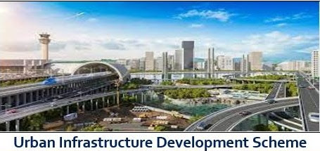
Government of India launched the Jawaharlal Nehru National Urban Renewal Mission (JNNURM) including sub-component namely Urban Infrastructure Development Scheme for Small and Medium Towns (UIDSSMT) and Urban Infrastructure and Governance (UIG) in December, 2005 for a period of 7 years i.e., upto 31stMarch, 2012. The UIDSSMT and UIG component was for infrastructure development with Central Assistance (CA) in small and medium towns of the States/Union Territories (UTs), whereas UIG component was for infrastructure development with central assistance in large Cities. The JNNURM was extended for a period of two years i.e., upto 31st March, 2014. All the projects of UIDSSMT and UIG components of JNNURM in which 50% or more of the CA had been released and physical progress was 50% or more as on 31stMarch, 2014 or were sanctioned during the Transition Phase (1stApril, 2012 to 31stMarch, 2014) of the Mission, were approved for funding under Atal Mission for Rejuvenation and Urban Transformation (AMRUT) upto 31stMarch, 2017. After closure of the Mission, all the projects were handed over to the States/UTs.
AMRUT was launched on 25thJune 2015 with focus on the development of basic urban infrastructure in the sectors of water supply, sewerage and septage management, storm water drainage, non-motorised urban transport and development of green spaces and parks in 500 selected cities across the country. Further, AMRUT Mission as such is not mandated to eradicate slums in the country. However, Pradhan Mantri Awas Yojana – Urban (PMAY-U)has In-Situ Slum Redevelopment (ISSR) as one of its four components under which slum rehabilitation can be taken up using land as a resource.
Development of urban infrastructure is a State subject. Therefore, it is the responsibility of the States / Union Territories (UTs) to frame policies and implement scheme for improving the quality of life for all including the poor and the disadvantaged people residing in its cities. However, Government of India, through various programmatic interventions, assists the States/UTs in their effort to provide basic amenities required to improve quality of life, such as shelter, water supply, sewage and toilets facilities to urban population. Such programmes, which are under implementation at present, are - Pradhan Mantri Awas Yojana – Urban (PMAY-U), Atal Mission for Rejuvenation and Urban Transformation (AMRUT) and Swachh Bharat Mission – Urban (SBM-U).
Wednesday, 22 March 2023
Drone Rules, 2021

These aim to make drone operations simpler for civilian drone operators.
Several requirements and approvals have been abolished which includes:
> Unique authorisation number, unique prototype identification number, certificate of manufacturing and airworthiness, operator permit etc.
> Number of forms reduced from 25 to 5 and types of fees from 72 to 4.
> The coverage of these rules has been increased to cover drones up to 500 kg in weight from 300 kg earlier.
> The quantum of fees, which was earlier linked to the size of drone, has been reduced and delinked from the size.
> For instance, the remote pilot license fee has been reduced from INR 3000 (for large drone) to INR 100 for all categories of drones; and is valid for 10 years.
Digital sky platform shall be developed as a user-friendly single-window system. There will be minimal human interface and most permissions will be self-generated.
Interactive airspace map with green, yellow and red zones shall be displayed on the digital sky platform
Green Zone :
> No permission is required for operating drones with an all-up weight of up to 500 kg in green zones. Green zone means the airspace
> Up to 400 feet that has not been designated as a red or yellow zone, and
> Up to 200 feet above the area located between 8-12 km from the perimeter of an operational airport.
Yellow zone :
> Drone operations in yellow zone require permission from the concerned air traffic control authorities — which could be either the Airports Authority of India, the Indian Air Force, the Indian Navy, Hindustan Aeronautics Ltd, etc as the case may be.
Yellow zone is the airspace Above 400 feet in a designated green zone, and Above 200 feet in the area located between 8-12 km from the perimeter of an airport (Earlier the perimeter was 45 km), Above ground in the area located between 5-8 km from the perimeter of an airport.
Red zone:
Red zone is the ‘no-drone zone’ within which drones can be operated only after a permission from the Central government.
No remote pilot licence required for micro drones (for noncommercial use) and nano drones. Classification of drones is as follows:
Nano drone: Less than or equal to 250 grams;
Micro drone: Greater than 250 grams and less than or equal to 2 kilograms;
Small drone: Greater than 2 kilograms and less than or equal to 25 kilograms;
Medium drone: Greater than 25 kilograms and less than or equal to 150 kilograms;
Large drone: Greater than 150 kilograms
No requirement for security clearance before issuance of any registration or licence.
No restriction on foreign ownership in Indian drone companies.
No import clearance required from DGCA though import of drones will be regulated by DGFT.
Safety and security features like ‘No permission – no take-off’ (NPNT), real-time tracking beacon, geo-fencing etc. will also be notified soon.
Subscribe to:
Posts (Atom)