
The cost of poor planning of Indian cities is estimated between 1.2% and 6.3% of the GDP by 2050 (Mani, Bandyopadhyay, Chonabayashi, Markandya & Mosier, 2018). Therefore, there is an urgent need for urban planning reforms that can facilitate integrated urban and regional planning approaches to climate-sensitive development, with active public participation in a time bound manner. At the same time, adoption and enforcement of existing mechanisms and guidelines, such as the revised URDPFI guidelines 2014 on preservation and rejuvenation of water bodies, green and eco-sensitive areas, need to be strengthened by the Urban Development Authorities (UDAs) and Urban Local Bodies (ULBs).
As of July 2019, out of the 7,933 cities and towns, 2,843 have statutory Master Plans. The disaggregation of Master Plans in the form of Zonal Development Plans/ Local Area Plans /Layout Plans are rarely available for most cities and towns, leading to haphazard and unplanned growth. Moreover, a review of existing plans suggests that many towns and cities that have Master Plans or Development Plans, which do not match with the growing infrastructural requirements and emerging challenges arising out of climate change, environmental and infrastructure requirements. Besides, lack of data to enable risk-informed planning, fund scarcity, and lack of qualified human resources (urban/town planners) pose serious challenges in formulation, implementation, and monitoring of climate actions at the city level. Spatial and temporal data loss and damage due to disasters remain a gap. In addition, timely implementation and monitoring of various spatial plans and provision for revision, need to be enabled with the use of the latest technological tools, such as Geographical Information System (GIS) and Remote Sensing techniques.
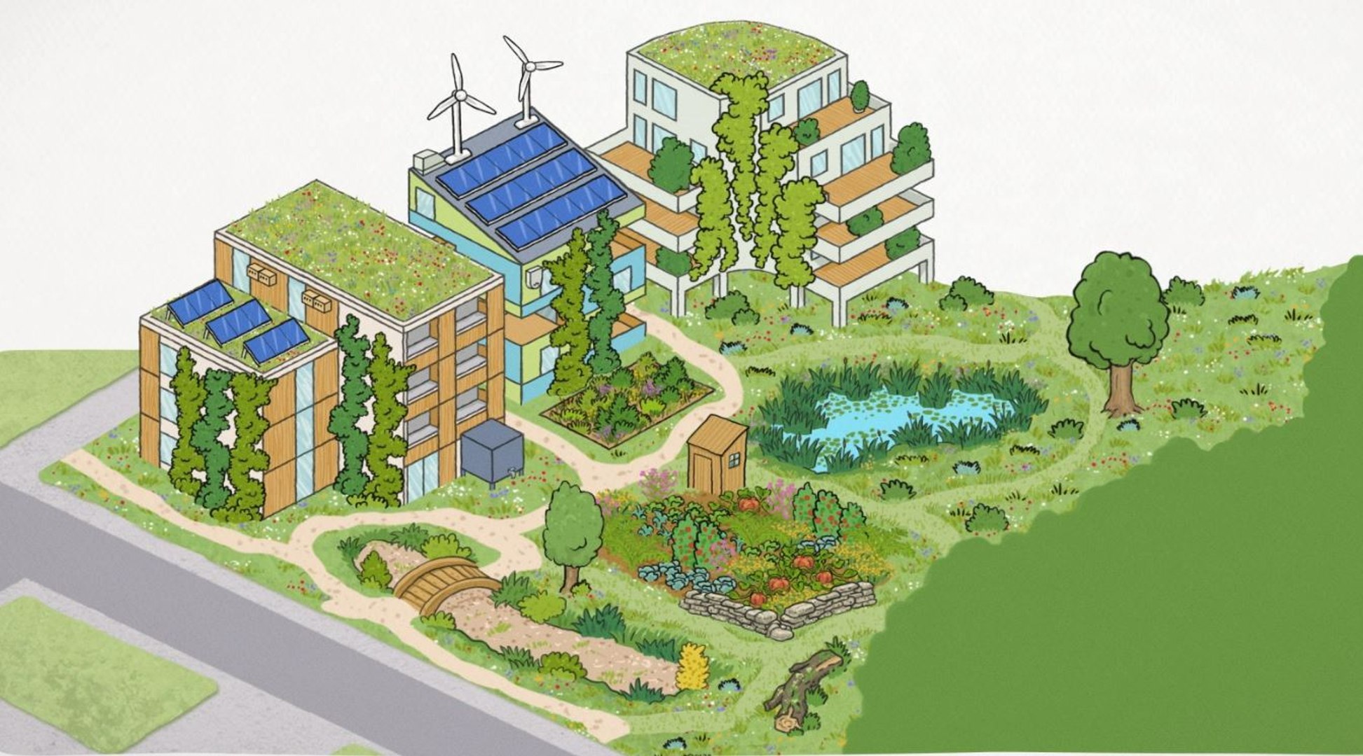
Urban environment consists of many aspects, including waterbodies, open spaces, and built-up areas. The waterbodies and open spaces help people adapt better to the adverse impacts of extreme climate events besides combating the urban heat island effect. These also combat water crisis, acting as reservoirs for draining, retention for groundwater recharge, for protection in case of floods, and for maintaining biodiversity. Further, local sources of freshwater decrease the dependence on energy for pumping purposes.

Similarly, sufficiently large and protected green spaces reduce the impact of human activities on climate, while biodiversity helps in carbon sequestration, air and water purification, mitigation of impacts of environmental pollution, noise reduction, and microclimate regulation. The effects of climate change and disasters (natural and man-made) are faced by urban inhabitants, and impact urban infrastructure. As effects of climate variability leading to extreme events are becoming more severe and frequent, the incidents of damage to urban infrastructure are also increasing. Therefore, all cities should be able to identify their potential hazards, vulnerabilities, and risk as well as be prepared for a prompt response mechanism to combat any disaster situations, including robust plans for recovery, reconstruction, and rehabilitation to ‘build back better’.